The Gump boarding house took two months to build on private land beside the Combahee River. Only a handful of rooms were finished inside, it was never built to code, and it was pulled down when the shoot ended. The bench went the other way. The production carried it into the north side of Chippewa Square in Savannah and left it behind when it went home.
19
places on the route
Six states and the District of Columbia — switch with the buttons above. Click a point to jump to its entry.
Greenbow, Alabama is invented, and the crew hardly went to Alabama at all. Principal photography ran from August to December 1993, and most of the film's Alabama sits within an hour of Beaufort, South Carolina: a Main Street, a school, a chapel, a shrimp dock, a hospital front and a jungle, every one of them playing somewhere else. The places that play themselves are mostly on the run, and two of them have taken the film's name since: Forrest Gump Curve, at mile 1.2 of a ticketed mountain road in North Carolina, and Forrest Gump Point, at mile marker 13 on U.S. 163 in Utah.
Seventeen days of the schedule were set on one 8,000-acre property on the Combahee River. Dan Rogers of the South Carolina Film Commission names what the production made of it: the Gump boarding house, Jenny's farm, the oak, grandma's trailer, the mailbox and the school bus stop, an oak alley, a pecan grove, two kitchen interiors, one an 1860s plantation kitchen and one for a wealthy house, police dog kennels, and the rice fields of the Mekong Delta.
Not all of that was carpentry. The boarding house was, and it left when the film left. The oak is a real tree, it is still standing, and the owner of the land would rather nobody knew where.
So Vietnam was built here first, 46 km inland from the islands where the rest of it was shot. The entrance is still visible from Combahee Road. The land is private and stays private.
Chippewa Square, Savannah
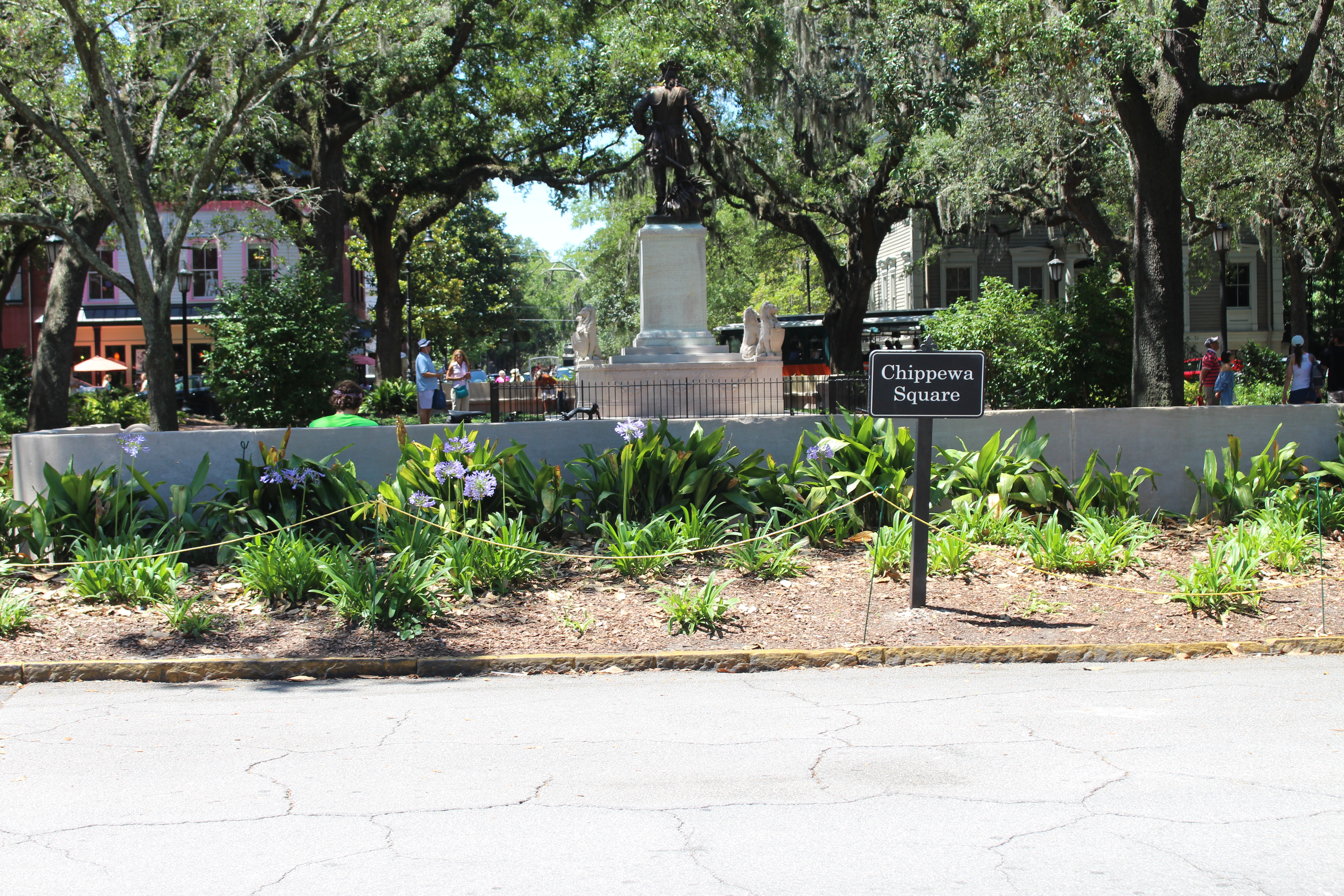
Chippewa Square from the north side, where the bench stood.
The bench stood on the northern edge, on Bull Street, and most of the film is told from it: the feather, the box of chocolates, one stranger after another sitting down beside him.
There is no bench in the square, and people come looking for it anyway. What is there is a square laid out in 1815, live oaks, planting beds, and James Oglethorpe on a plinth in the middle, facing south with his sword drawn, towards the Spanish in Florida.
Savannah History Museum
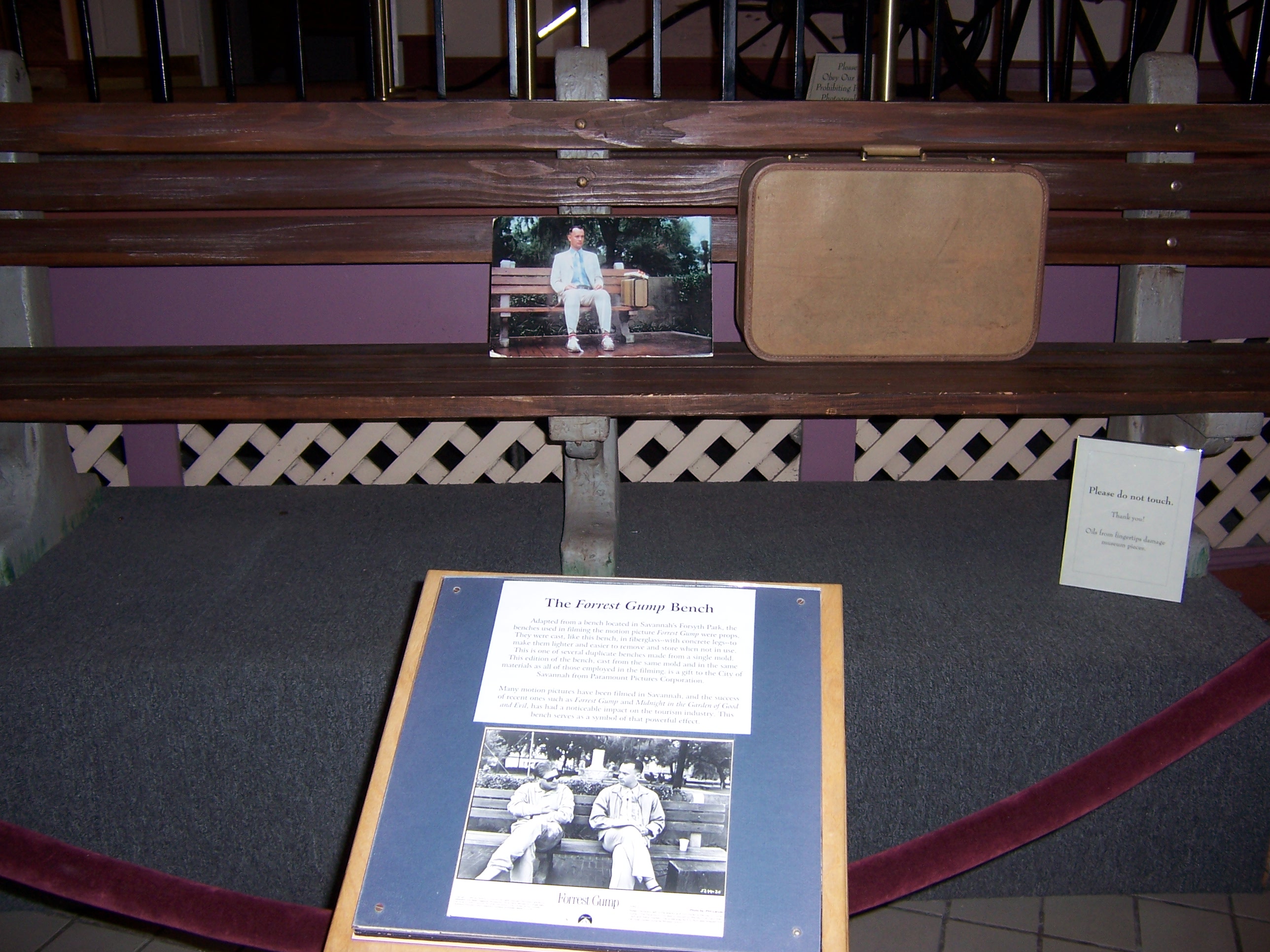
The bench on display at the Savannah History Museum, roped off, with its own label.
No filming here. This is where the bench went: six hundred metres west, in the old Central of Georgia Railway station on Martin Luther King Jr Boulevard, roped off, with a label explaining what it is doing indoors.
Main Street plays the whole of downtown Greenbow, 35 miles north-west of Beaufort. The barber shop, the train coming through, the run down the street. The shopfronts have kept their set dressing since.
The storm drain that catches the boy's leg brace is here as well, remembered by Frank McClure, who lives in the town.
The principal takes out a chart and shows Mrs Gump where her son falls on it. That office is 53 km inland, in a school that closed and was restored as an arts and civic centre, the Colleton Center, at 494 Hampton Street.
Jenny sings for a room of men in what the film gives as a truck stop. The room is a family seafood restaurant twenty minutes from downtown Savannah, on the bank of the Ogeechee, run by the Love family since 1949.
They date their own part in it: Paramount picked the place in October 1993. The dining room and the deck outside seat more than three hundred, and what the restaurant has to say about the alligators and the occasional manatee in the river is that they are not pets and are not to be fed.
Bayou La Batre is Beaufort
Lucy Point Creek, between Lady's Island and Coosaw Island
Bayou La Batre is a real town on the Alabama coast. The shrimp boat scenes did not go there: the Jenny works a tidal creek 7 km north-east of Beaufort.
The dock and boathouse that play the Bubba Gump Shrimp Company are on the Coosaw Island side. They belonged to Stan and Marie Lawson, who ran the place as Coosaw Marine. Hurricane Matthew destroyed it. It has been rebuilt.
Stoney Creek chapel, McPhersonville
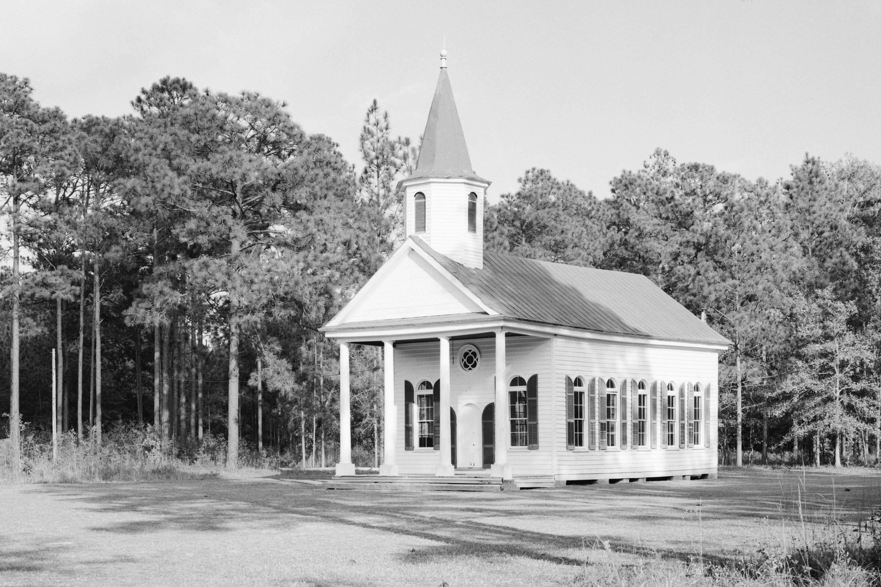
Stoney Creek chapel in McPhersonville, photographed for the Historic American Buildings Survey in 1987.
Photo: Jack Boucher, Historic American Buildings Survey · Public domain (US federal government work) · Wikimedia Commons
Forrest and Lieutenant Dan pray for shrimp in the Four Square Gospel Church, which is a white clapboard Presbyterian chapel standing on its own among pines, with a portico and a small spire. It was built around 1833 and it is the only antebellum building left in McPhersonville. It went on the National Register in 2002.
USCB Center for the Arts, 801 Carteret Street, Beaufort
The hospital Forrest endows is the front of the arts building on the University of South Carolina Beaufort campus, downtown, 800 m from the Woods Memorial Bridge. Nothing about the building was touched. The sign over the door was changed to Gump Medical Center digitally.
College, the war, and the Mall
Bovard Administration Building, University of Southern California
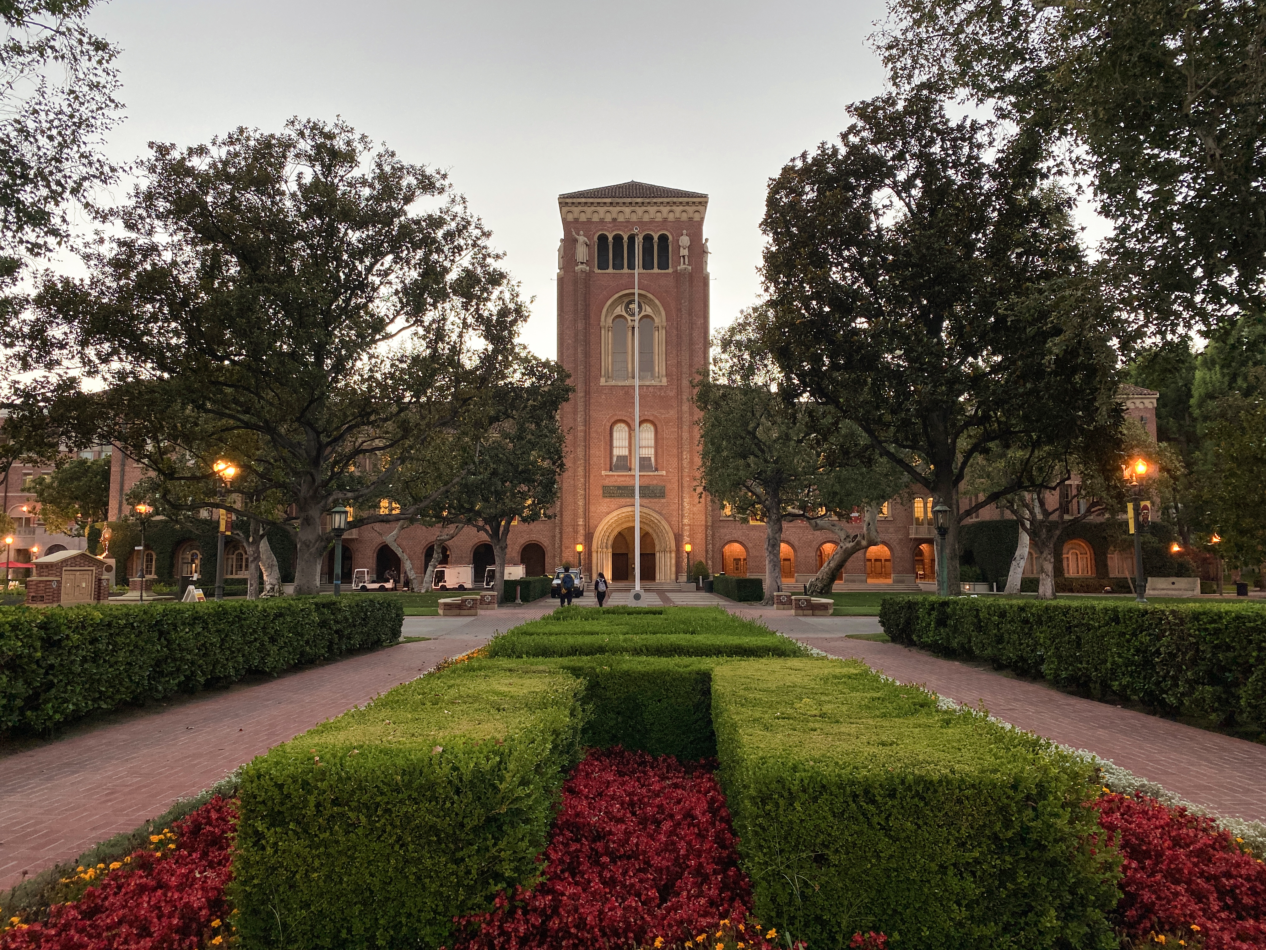
Forrest's graduation from the University of Alabama was shot in Los Angeles. He walks across the stage of Bovard, the brick tower with the arched entrance, and most of the film's college scenes are on that campus. USC's conditions for crews include one that shows on screen: nothing may identify the university or name any of its buildings.
Not all of Alabama's football is in California. The practice field where his speed is first noticed is the field at Wade Hampton High School in Varnville, the same town that plays downtown Greenbow.
The ambush, and the lagoon where Forrest carries the wounded out one at a time. This is a state park 21 km east of Beaufort with five miles of beach, a saltwater lagoon and a maritime forest, and more than a million visitors a year make it the most popular state park in South Carolina.
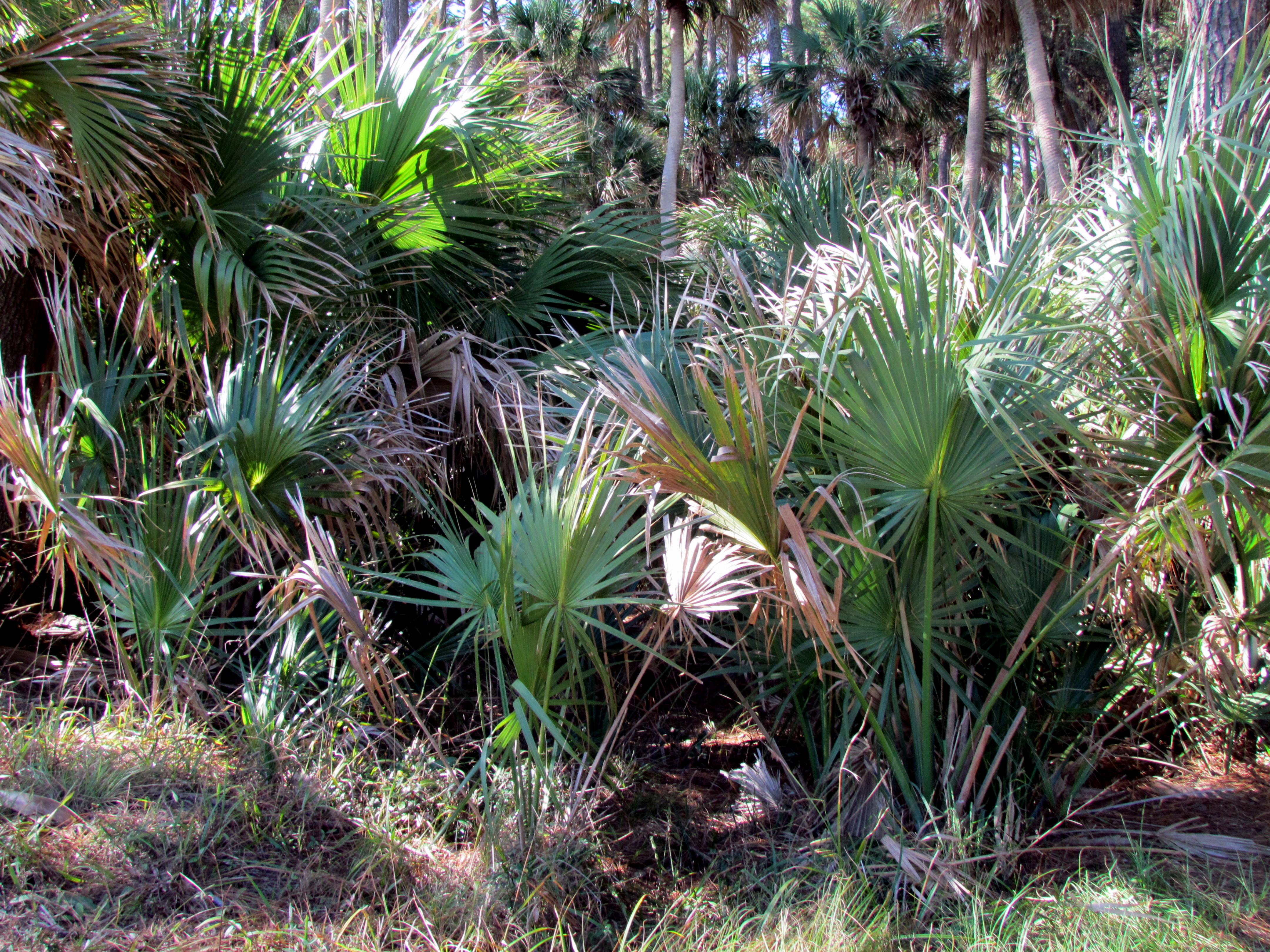
It did not look tropical enough. More than twenty palmettos were planted for the Vietnam scenes.
The lighthouse was built in 1859, destroyed in the Civil War, and rebuilt in 1875 in interchangeable cast-iron sections, so that it could be taken apart and moved if it ever had to be. In 1889 the sea forced them to do exactly that, and it now stands 1.3 miles from where it started. It is the one lighthouse in South Carolina open to climbers: 167 steps, shut for repairs in 2022, open again since May 2026.
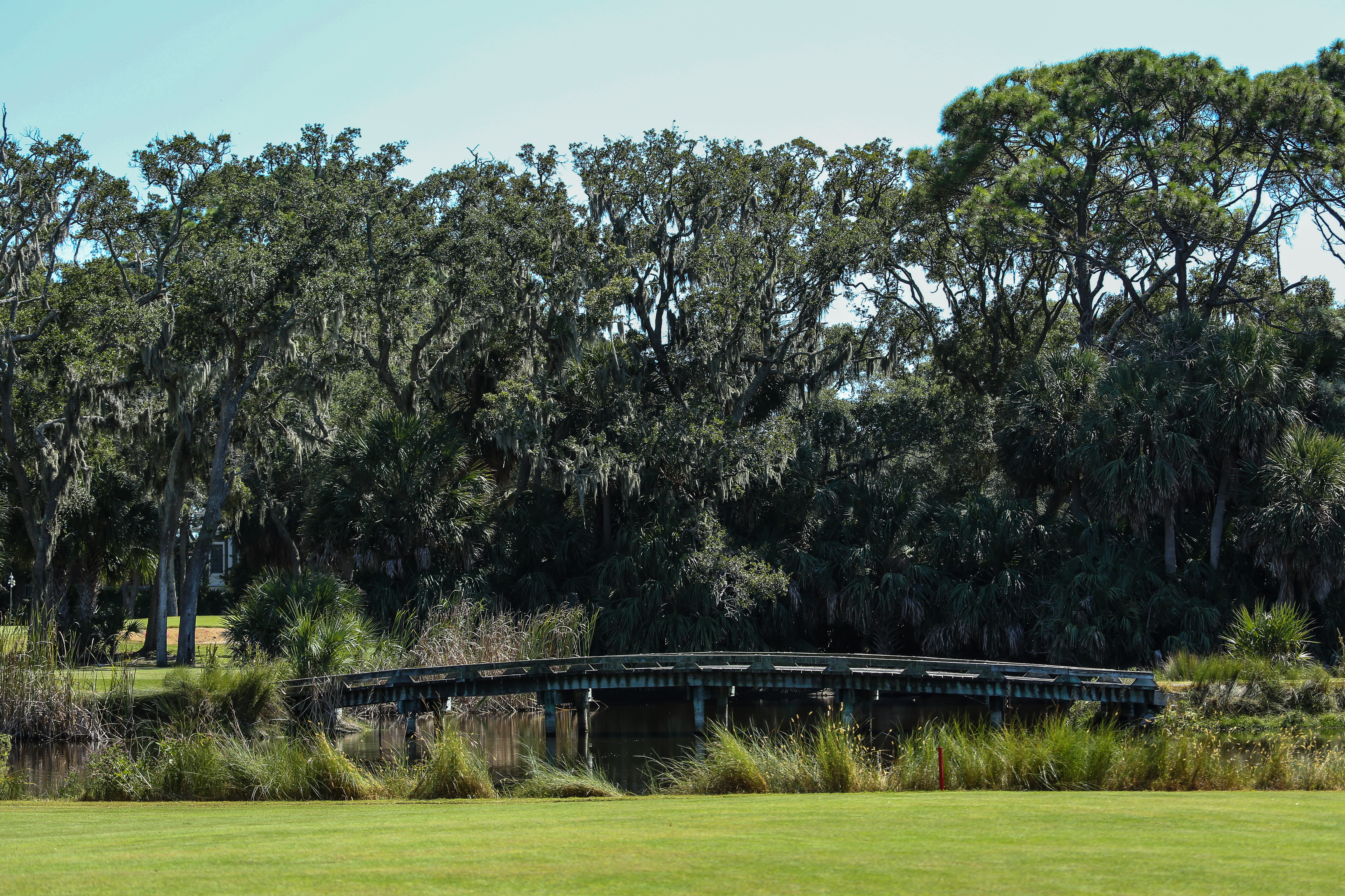
The rest of Vietnam, including where Forrest first meets Bubba and where he meets Lieutenant Dan, is a golf course on the next island south, 3 km away. The mountains behind it and the taller palms were added afterwards.
Fripp Island is a private gated community. You get on it as a guest or not at all.
Lincoln Memorial Reflecting Pool
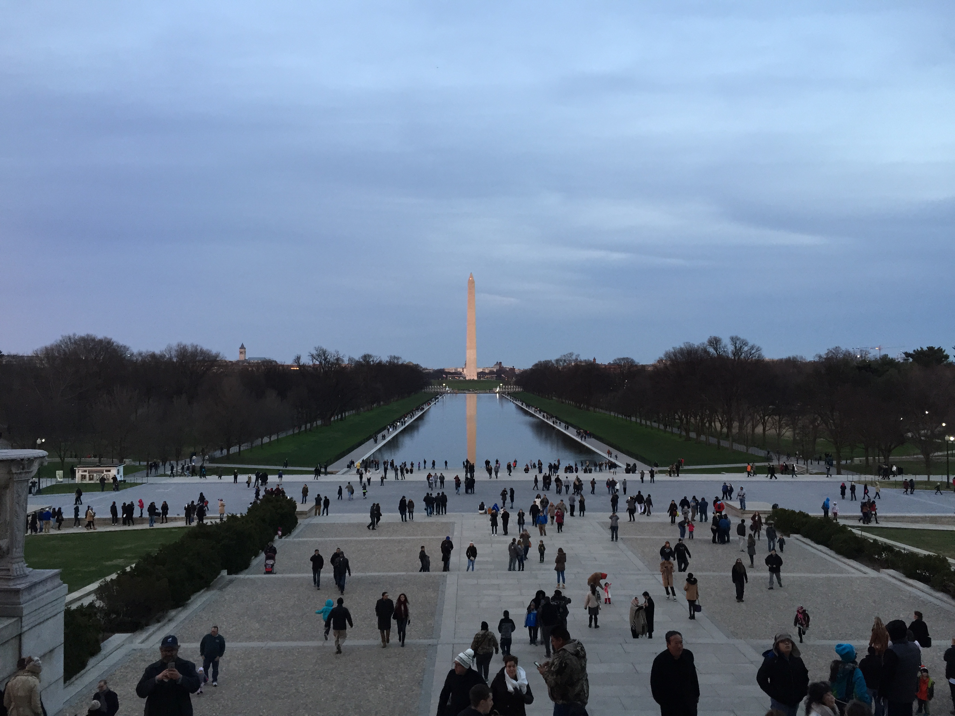
The view from the Lincoln Memorial steps, which is where the camera stood.
Forrest is pushed on stage at an anti-war rally, the microphone is cut, and he finds Jenny in the crowd. Two days of filming, about 1,500 extras: between takes they were moved into another quadrant of the ground, away from the camera, and then multiplied by computer until they filled the Mall.
The pool itself was not finished in time for the memorial's dedication in 1922. Forrest and Jenny meet halfway along it, in the water.
The run
Richard V. Woods Memorial Bridge, Beaufort
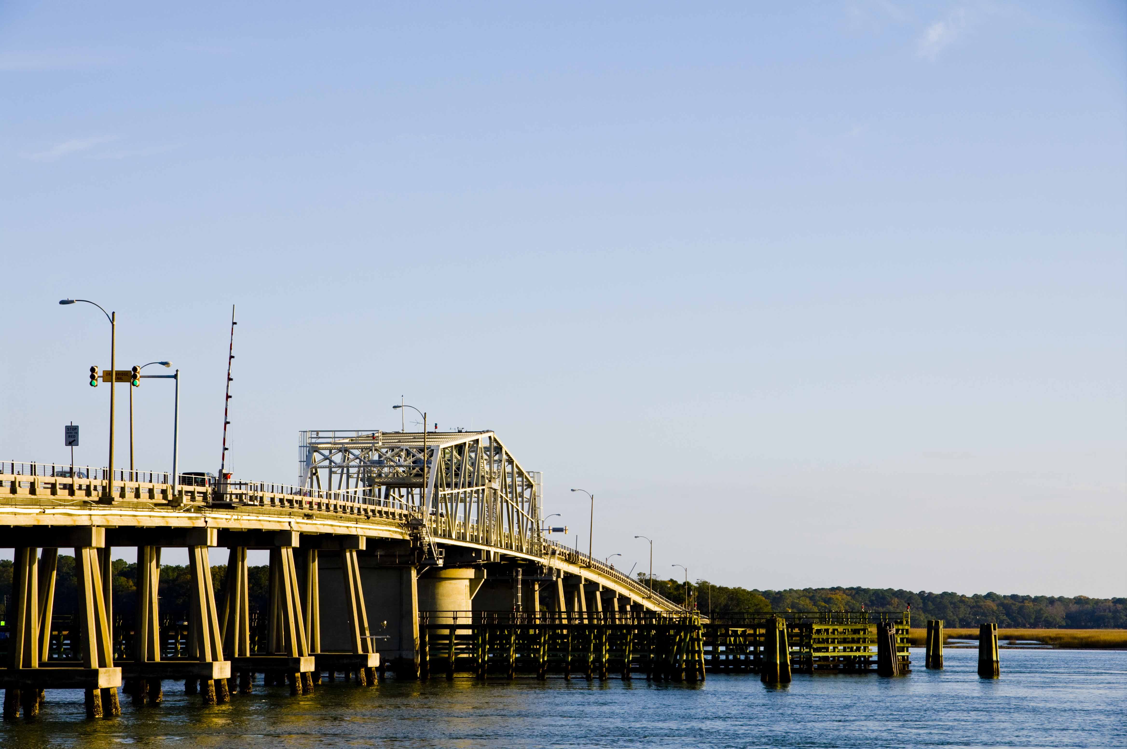
The Woods Memorial Bridge from the Beaufort side. The swing span turns for boat traffic.
The reporters catch up with him on a bridge, over a river a sign identifies as the Mississippi. It is the Beaufort River, 30 km from the boarding house set. Nothing about the bridge was dressed except that sign.
It is a swing span, and it still turns for boat traffic, one of the few working swing bridges left in the state. Every year the Run, Forrest Run 5K goes over it.
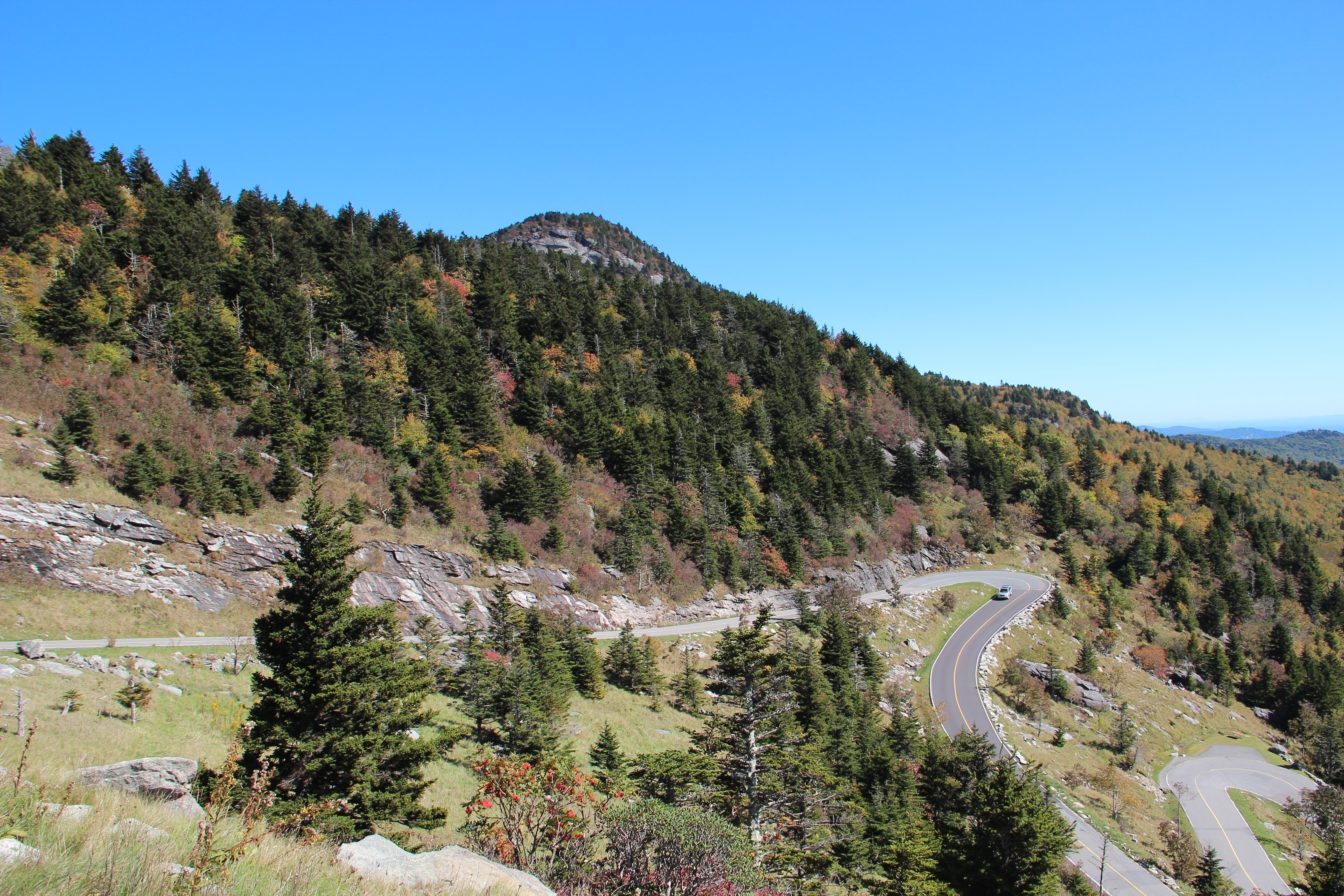
Forrest Gump Curve, Grandfather Mountain
The switchbacks on the road up Grandfather Mountain.
Five seconds of film, on the switchback where the crowd of followers first appears behind him. The mountain named the corner after it and put it in the mile-by-mile guide to its own road: mile 1.2, between the Wilson Center and the Mile High Swinging Bridge, picnic area just before.
English Wikipedia puts this shot on the Blue Ridge Parkway near Grandfather Mountain. The mountain says otherwise, and the mountain owns the road. The curve is inside the nature park, past the ticket gate, and it is not the Parkway.
The man running is Jim Hanks. Staff on the mountain had been told the brother would double for the star, who was filming in South Carolina; Tom Hanks turned up anyway. It was a clear Saturday in October 1993. Walking and running on the road are not allowed. You drive it.
Another piece of the run is the road that leads down to Antler Hill Village and the winery, 90 km south-west of the curve on the Vanderbilt estate.
The western view of Biltmore House above the Lagoon turns up in The Swan in 1956 and again in Being There in 1979. A carriage crosses the red brick Bass Pond bridge in The Last of the Mohicans, and the bridge is by Richard Morris Hunt, who designed the house. Richie Rich shot inside, in rooms left largely as they were, Vanderbilt family portraits and all. Hannibal used the arched Lodge Gate, the façade of the house, and the Antler Hill barn, which was still unrestored then.
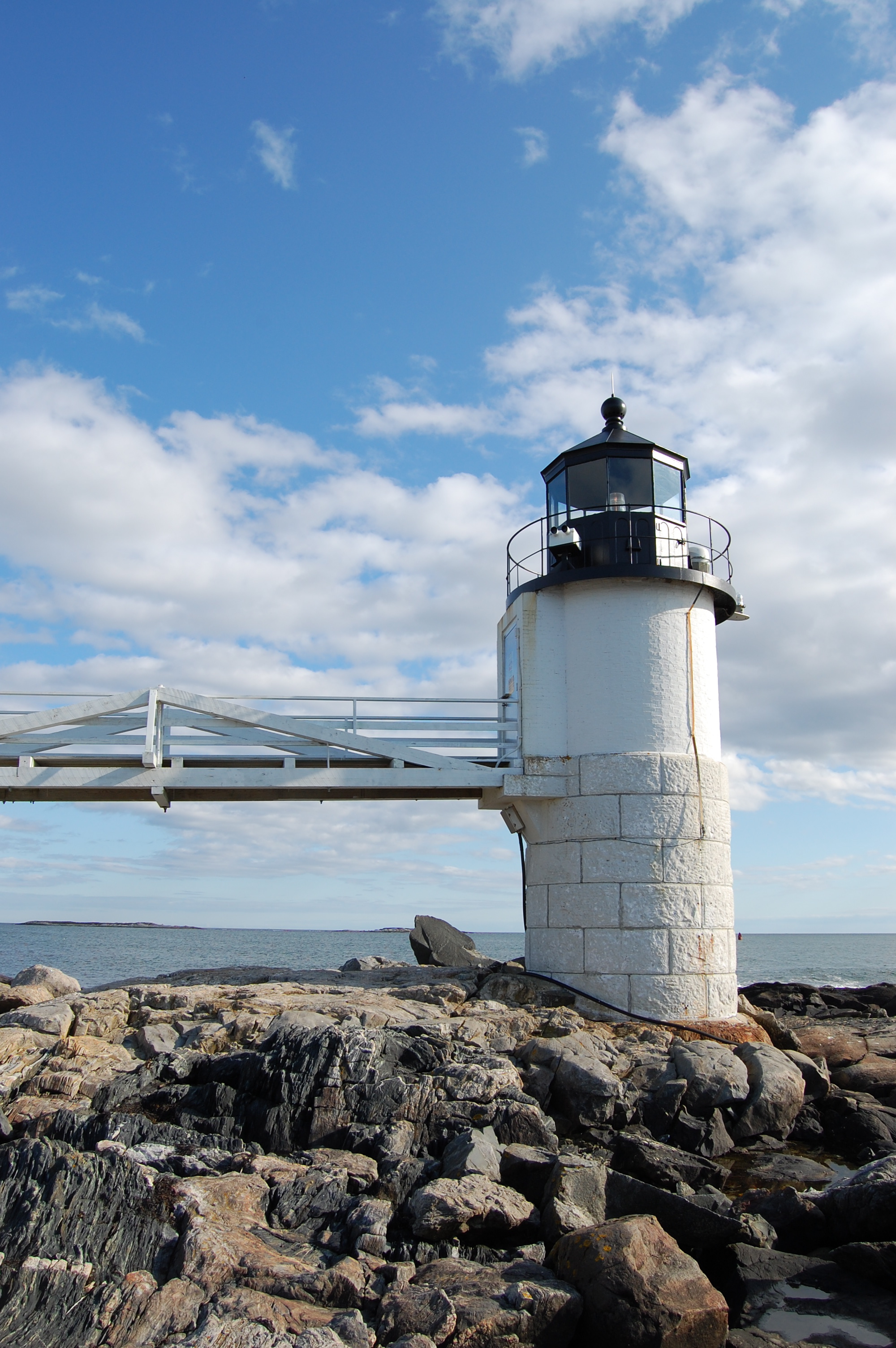
The turn. He runs out along the wooden walkway, reaches the tower, stands there, and comes back. The walkway is a plank deck on granite piers and it is still exactly that.
The tower went up in 1858 at the water's edge: twelve feet of granite, twelve feet of brick, cast iron lantern on top. The light was automated in 1971 and the last keeper left. A LORAN station had taken over the inside of the keeper's house, and when that equipment went obsolete the Coast Guard boarded the house up, in 1980. The town leased the grounds, three years and then five, to keep the place open to the public. The St. George Historical Society took on the restoration in 1986, and in June 1998 the town owned the station outright, leaving the Coast Guard the light and the fog horn and nothing else.
The museum that opened in the keeper's house in 1990 is staffed entirely by volunteers.
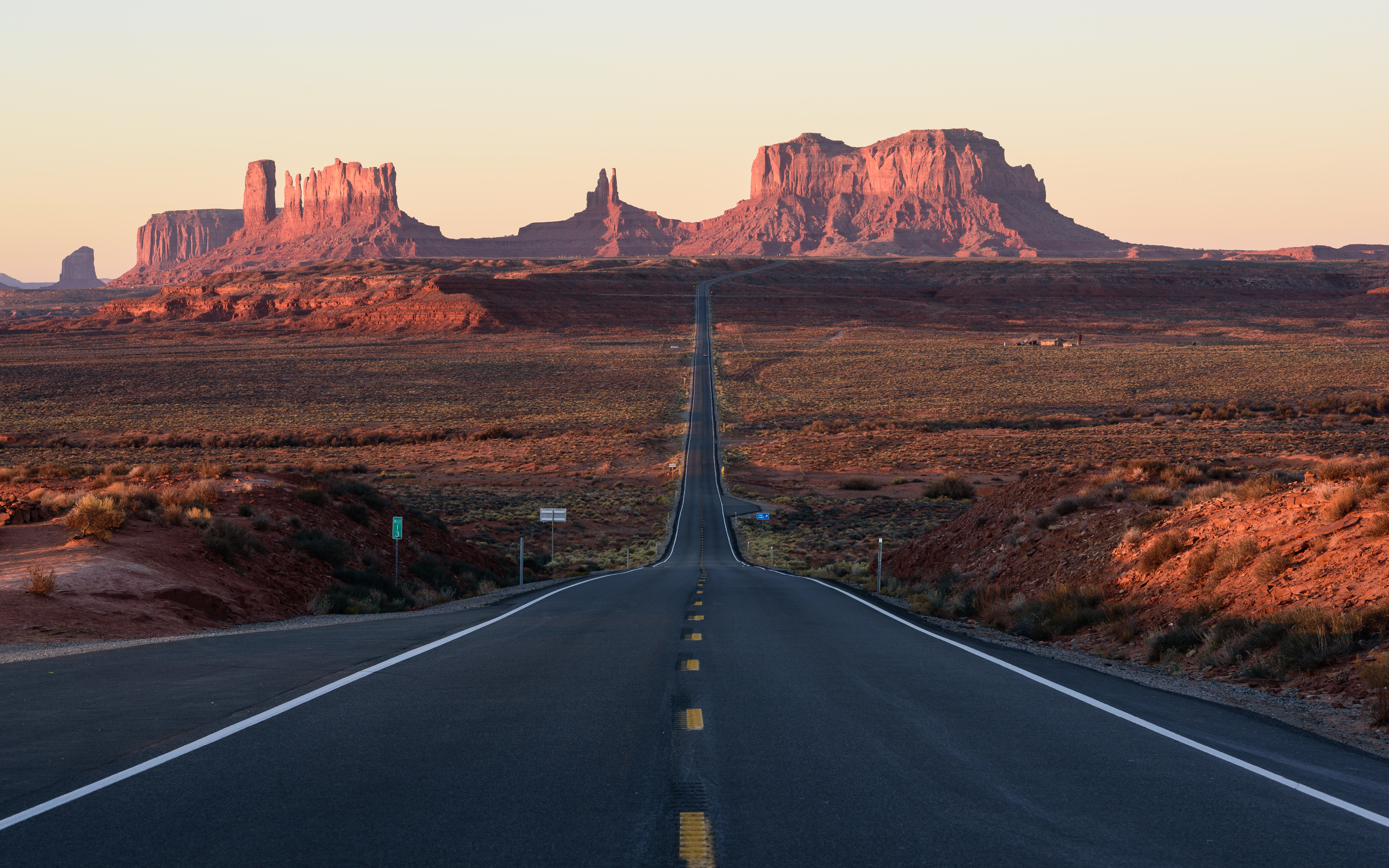
Forrest Gump Point, U.S. 163
US 163 looking south towards Monument Valley at first light.
Mile marker 13, on the Navajo Nation, north of Monument Valley Navajo Tribal Park and 3,500 km from the walkway in Maine. The road runs dead straight at the Mittens, then drops and rises again, and he stops on the rise and says he is tired.
The traffic on this highway has injured and killed people taking the photograph from the middle of the road. There are pull-offs. Use the shoulder.
Glacier National Park, Montana
A history of moviemaking in Utah is an odd place to find Montana, and it is where Glacier National Park comes into this film: James V. D'Arc's book, published in 2010, puts additional scenes in Arizona, in Utah's Monument Valley, and in Glacier.
The hotel that stopped being a hotel
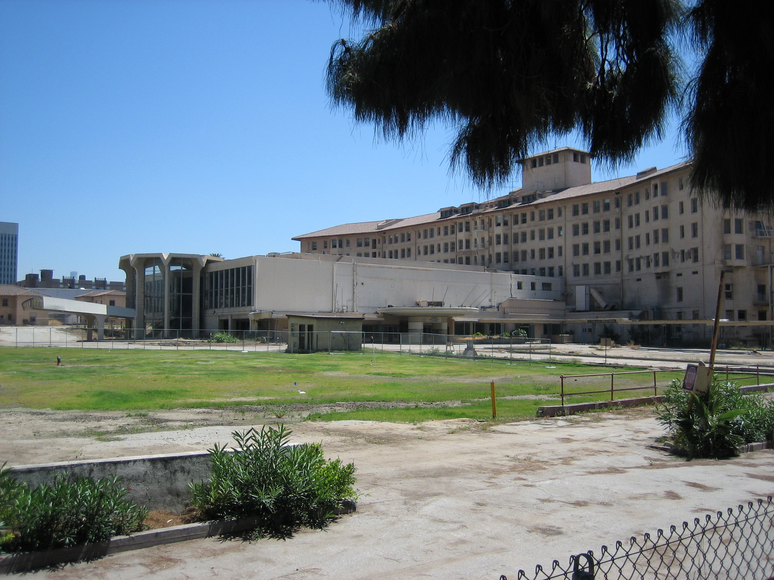
Ambassador Hotel, 3400 Wilshire Boulevard
The Ambassador in August 2005, fenced off, months before the demolition crews finished with it.
The Ambassador stopped taking guests in 1989 and spent the sixteen years after that working almost full time as a film set. Location guides put this film inside it, and LAist listed it in 2009 among the films shot there. Neither names a scene, and nobody has published one since.
The other films at this address are easier to follow. The Beverly Wilshire interiors in Pretty Woman are this building: the lobby, and the Embassy Ballroom where Barney teaches Vivian which fork to use. The penthouse in that film was a set, built either into the hotel's presidential suite or on a soundstage in Burbank, depending on which account you take. Se7en used the bungalows on the grounds. Catch Me If You Can came three years before the wrecking crews.
Robert Kennedy was shot in the hotel kitchen in June 1968, and the last crew to work in the building was there to restage that night. Bobby filmed in the rooms where it happened, with the demolition machines already on the lawn and a school bus parked across from the entrance to hold them off. The hotel came down across 2005 and 2006. Six schools named for Robert F. Kennedy stand on the site now.