The landing sequence was shot on a beach in County Wexford, 511 km from the one it depicts. The production had looked at the real Omaha Beach first and found it too built up to use. The camera did reach Normandy for one thing: the cemetery on the bluff directly above Omaha, where the film opens and closes.
6
places on the route
Three countries — the landing was shot in County Wexford, 511 km from the beach it depicts. Switch with the buttons above; click a point to jump to its entry.
Principal photography began on 27 June 1997 and finished twelve weeks later, on 13 September. Ireland came first, then England from the end of August.
filmed herewhere it really happened
Ireland
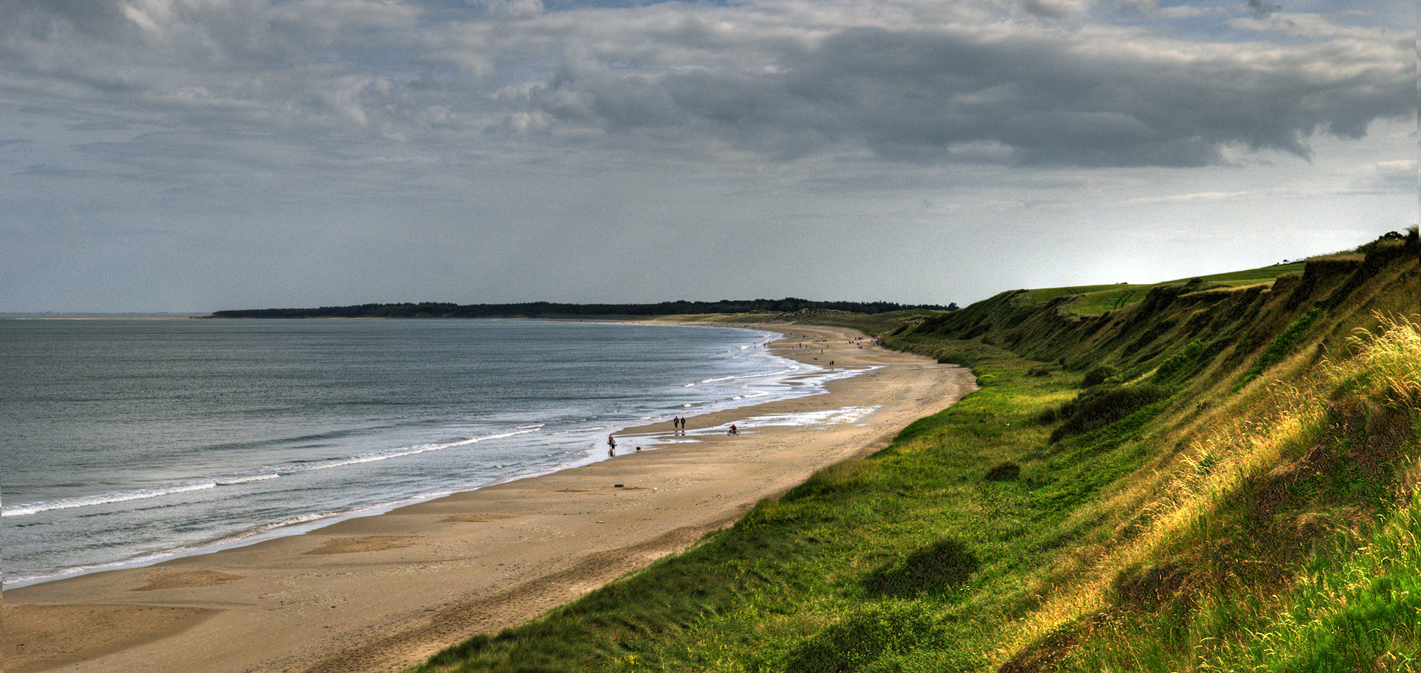
Ballinesker Beach, Curracloe
Ballinesker Beach looking north along Curracloe Strand
Photo: Michal Osmenda · CC BY-SA 2.0 · Wikimedia Commons · originally posted to Flickr as Ballinesker Beach, Co. Wexford
A five-kilometre stretch of sand on the east coast of County Wexford, 8 km north of Wexford town. It is the middle of a sixteen-kilometre run of beach that starts at Raven Point, a Special Area of Conservation, and ends at Ballyconniger Head. Blue Flag, free car park, toilets, dunes behind it.
The landing was filmed here over three to four weeks for around twelve million dollars. About 1,500 people worked on it. The men coming out of the water were Irish Army reservists, and they wore wet suits under the uniforms against hypothermia. Bullet strikes were made with air pipes buried in the sand and under the shallows, so an extra who ran over one counted as hit and had to drop. More than a thousand mannequins padded out the numbers. Two of the landing craft were wartime Higgins boats; the others were 1950s craft brought in from California, Donegal and Southampton.
Curracloe village, 4 km inland, had no three-phase electricity until the production needed it, and got connected. Spielberg watched the day's footage each evening in a parish hall. When the crew left, an ecological protection order kept the crew there another month putting the beach back the way they found it.
The Irish beach scene in Brooklyn was shot on the same strand.
England
West Kennett, Wiltshire
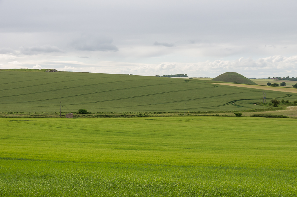
Fields south of West Kennett, the Wiltshire downland that played Iowa
Fields in the Avebury parish, standing in for Iowa. The Ryan farmhouse where Mrs Ryan is told about her sons was built for the film and taken away afterwards.
The hamlet sits inside the Stonehenge and Avebury World Heritage Site. West Kennet Long Barrow, a Neolithic chambered tomb, is about 500 m to the south-west; Silbury Hill, the largest artificial mound in prehistoric Europe, is about 900 m to the north-west. The National Trust car park for both is a kilometre west along the A4.
Thame Park, Oxfordshire
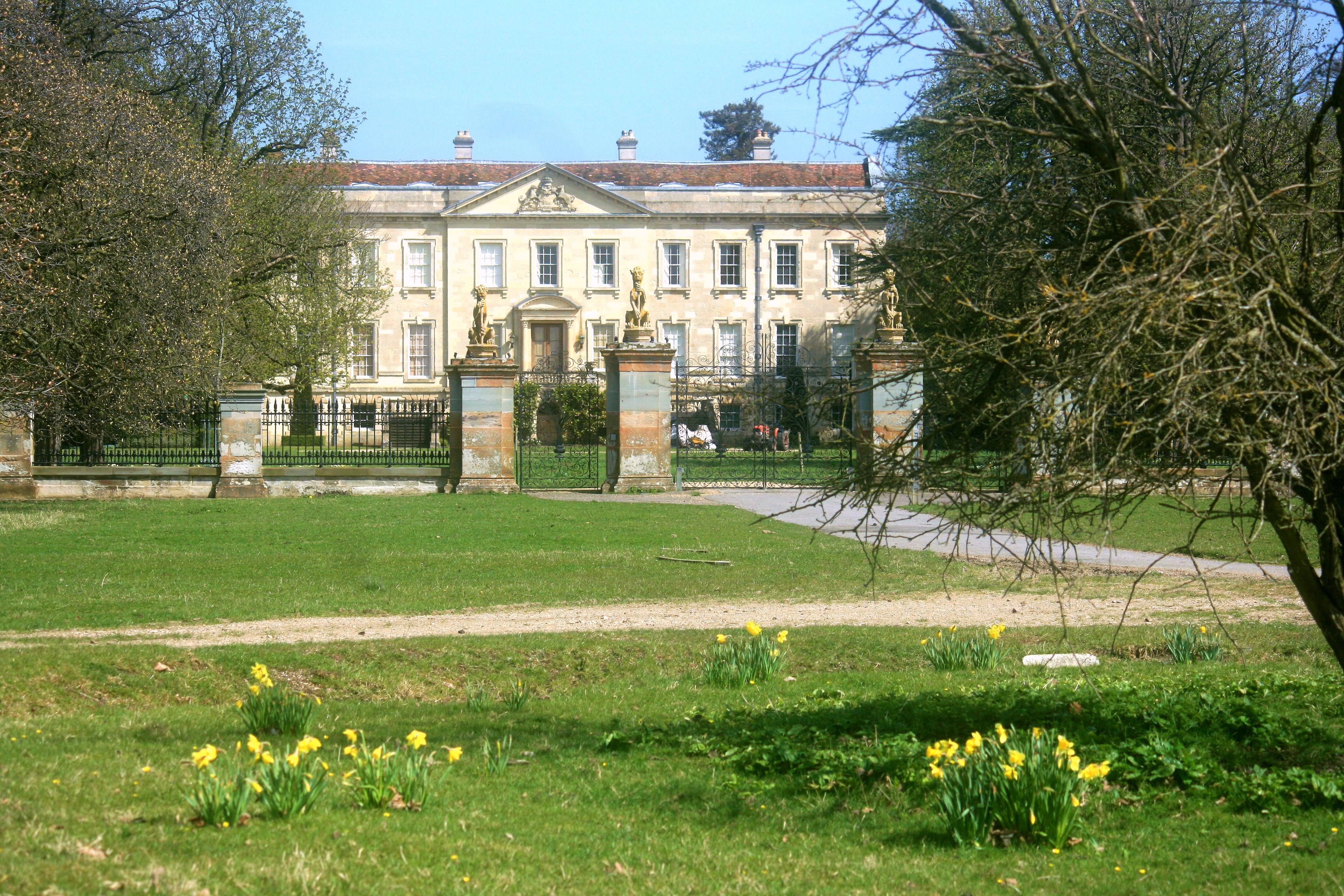
Thame Park House. The chapel used for the church scene stands 150 m to the north-west
A Cistercian abbey was founded on this ground about 1140. Sir John Williams bought it in 1547 and pulled down the abbey church and most of the buildings, keeping the Abbot's Lodgings, which are now the south wing of the house. The sixth Viscount Wenman added a Palladian west front in the late 1740s. The park was laid out later that century and the serpentine lake was probably made out of the monastic fishponds.
The squad's fight with the machine-gun nest and the ambush of the half-track were shot on the grounds. The bombed French church where the men spend the night is the chapel that stands 150 m north-west of the house: early fourteenth century, probably built by the abbey outside its own gates for travellers, rendered and given gothic trim in 1836 for Sophia, Baroness Wenman. Shoppers on Thame High Street, two kilometres away, heard the explosions and did not know why.
The park had been used for war work before. In the Second World War it was Special Training School 52, where the Special Operations Executive taught security to its wireless operators.
The estate is private and there is no admission. Rights of way cross the park from the Thame road, and the house is visible from them. Longitude was the last big drama shot here, using the interior for John Harrison's submission to the Admiralty.
Hatfield Aerodrome, Hertfordshire
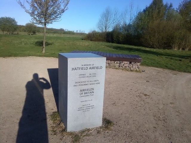
The memorial stone on the old airfield, giving its opening and closing dates
De Havilland's airfield opened in June 1930 and closed on 8 April 1994; both dates are cut into a memorial stone that now stands on the grass. The Mosquito was built here. On 3 October 1940 a Junkers Ju 88 put four bombs into the factory, killing 21 people and injuring more than 70. A hard runway went down in 1947 for the Vampire and the Comet. British Aerospace stopped building aircraft in 1993, and the last aeroplane off the main runway was a Chipmunk.
Three years after that, the empty site became the production's backlot and English base. Ramelle, the invented French town where the film ends, was built on it: nearly three blocks of full buildings and facades, based on five real towns where fighting had happened, with a 900-foot river dug and lined so the water level could be controlled. Craters were blown into the ground around it. The interior of the war office where the letters are read was also shot at Hatfield. The production spent eight million pounds on contracts with suppliers in the area.
Spielberg and Hanks came back to the same ground for Band of Brothers. Work on that set started in December 1999 and shooting ran from April to December 2000: sixteen acres, close to a mile of river, and one set rebuilt into Bastogne, Eindhoven and Carentan one after another.
Redevelopment kept the grade II* listed flight test hangar and the administration buildings, and took out the runway and the taxiways. The hangar is a private members' gym now. The rest is the University of Hertfordshire's de Havilland campus, a business park and housing, on streets named The Runway, Comet Way and Mosquito Way. A four-kilometre history trail with ten information boards runs round the site; it opened in November 2010 and the leaflet is at the campus reception.
Normandy
Normandy American Cemetery, Colleville-sur-Mer
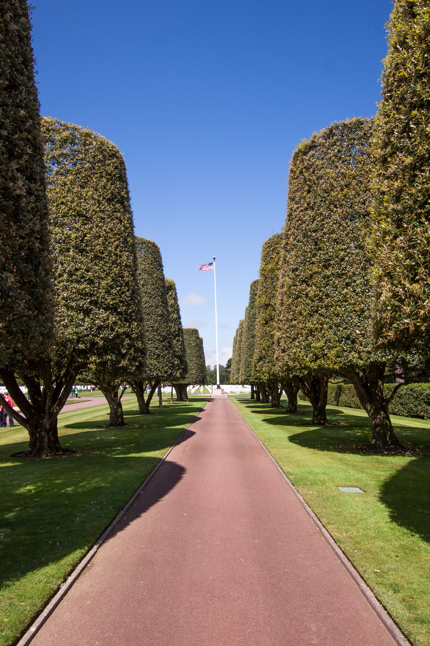
The mall at Colleville-sur-Mer, looking towards the flagpole
The film opens and closes here, and this is the real place, not a stand-in.
The ground was a temporary burial site before it was anything else. The US First Army opened the St Laurent cemetery on 8 June 1944, two days after the landing, the first American cemetery on European soil in the war. What stands now covers 172.5 acres, holds 9,389 graves and carries 1,557 names on the Walls of the Missing, with a rosette beside each man since found. It was dedicated in 1956. France gave the land to the United States.
Two of the four Niland brothers, Preston and Robert, are buried here. Their family is the one the script came from: three brothers reported dead, the fourth pulled out of the fighting and sent home. One of the three, held in a Japanese camp in Burma, turned out to be alive.
The cemetery is open daily except 25 December and 1 January, and admission is free. There is a visitor centre, and the flag comes down an hour before closing. The path that used to run from the cemetery down to the beach was closed in 2016 on security grounds, so the walk down has to start somewhere else.
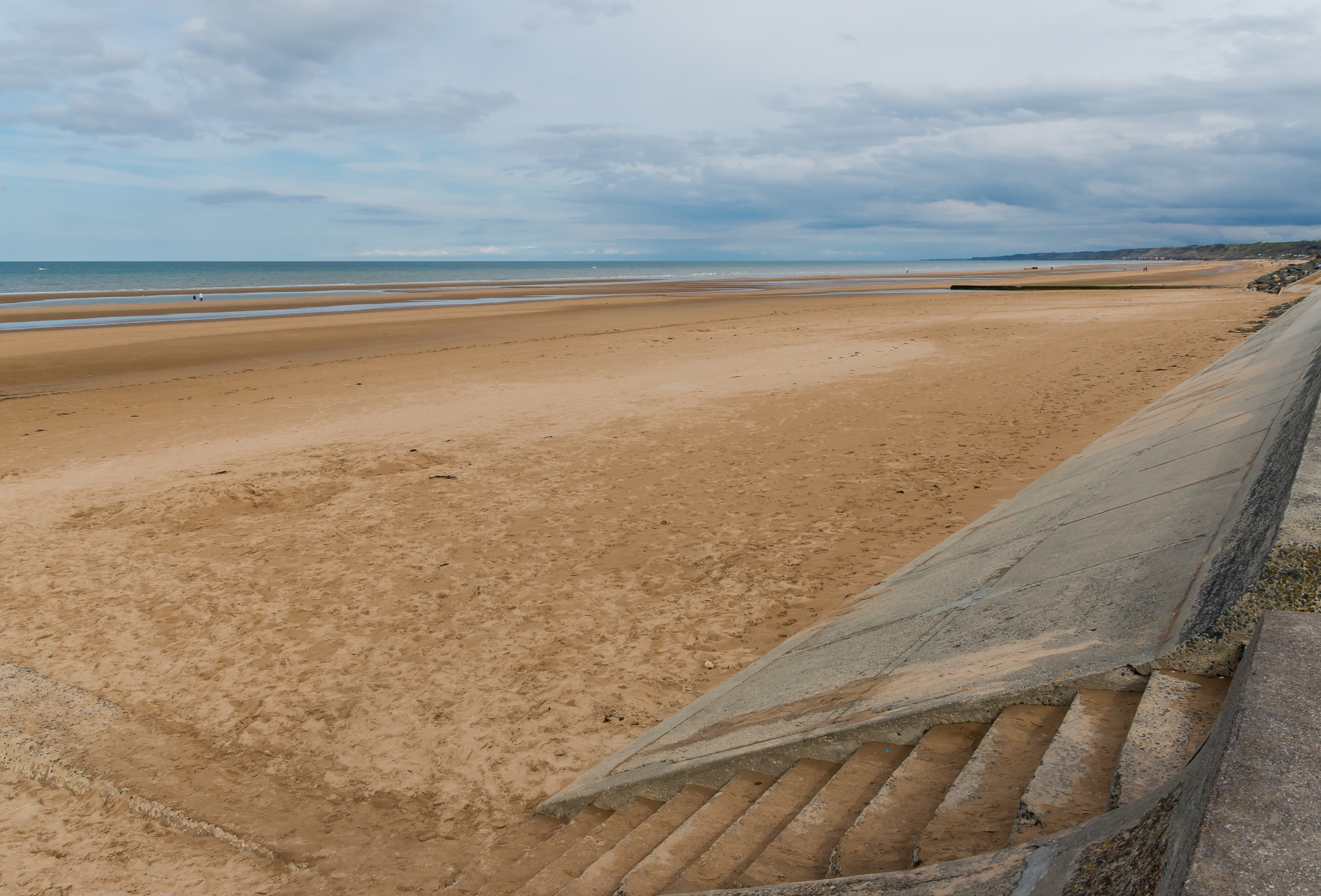
Not a filming location. It is the eight kilometres of coast the opening sequence is about, running from Sainte-Honorine-des-Pertes west to Vierville-sur-Mer, and the cemetery stands 1.3 km from the middle of it.
American forces put 34,000 troops ashore here on 6 June 1944. One count gives 2,400 casualties at Omaha that day; the accurate figure for V Corps is not known and estimates run from 5,000 to over 6,000 killed, wounded and missing.
The scouts who came here in the mid-1990s were right about the state of the place. The shingle bank the first waves crawled to was cleared away by engineers within days of the landing so that supplies could come off the boats faster. The beachfront is more built up than it was, the beach road has been extended, and the villages behind it have grown into each other. The shape of the beach itself has not changed, the German positions above it can still be walked into, and the broken sections of the Mulberry harbour show at low tide.
About 0.18 per cent of the sand at Omaha is metal, along with glass and iron beads. Some of it is probably from the fighting.